21-23 Bolsover Street,
Rockhampton.
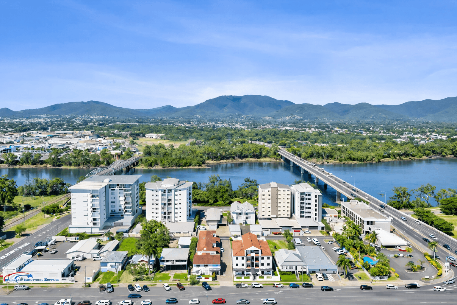
Cityville sits on the western edge of the Rockhampton CBD, one block back from the Fitzroy River. From your front door it’s a two-minute walk to Quay Street’s heritage dining strip, seven minutes by car to Rockhampton Airport, and an easy forty-minute drive east through the Berserker Range to Yeppoon, Emu Park, and the Great Keppel Island ferry.
Distances & travel times
2 min
Rockhampton CBD
Walking
7 min
Airport
By car
5 min
Botanic Gardens
By car
10 min
Mt Archer
By car
45 min
Capricorn Caves
By car
1 hr
Great Keppel Island
Drive + ferry
How far is everything from Cityville Apartments & Motel? Every distance in Rockhampton, measured.
Below is every distance that matters from Cityville — measured door-to-door in June 2026, in kilometres and real driving minutes. Walking times shown where the walk is twenty minutes or less. If you’re deciding where to stay in Rockhampton, this is the table the booking sites can’t give you.
Town
| Destination | km | Drive | Walk | Notes |
|---|---|---|---|---|
| Rockhampton CBD (East Street) | 1.6 | 3 min | 20 min | |
| Riverside precinct / Quay Street | 1.9 | 4 min | — | Two minutes' walk via Bolsover and Quay (shorter than the drive routing). |
Government
| Destination | km | Drive | Walk | Notes |
|---|---|---|---|---|
| Rockhampton Regional Council | 1.7 | 4 min | — | |
| Rockhampton Courthouse | VERIFY | — | — | East Street, Rockhampton — distance pending Google sense-check. |
Transport
| Destination | km | Drive | Walk | Notes |
|---|---|---|---|---|
| Rockhampton Airport (ROK) | 3.5 | 6 min | — | |
| Rockhampton railway station | 2.8 | 6 min | — | |
| Bruce Highway — southern exit (Gladstone Rd) | 2.5 | 5 min | — | |
| Bruce Highway — northern exit (Yaamba Rd) | 3.2 | 5 min | — |
Health
| Destination | km | Drive | Walk | Notes |
|---|---|---|---|---|
| Rockhampton Hospital | 1.9 | 4 min | — | |
| Mater Private Hospital Rockhampton | 4.1 | 8 min | — |
Education
| Destination | km | Drive | Walk | Notes |
|---|---|---|---|---|
| CQUniversity North Rockhampton campus | VERIFY | — | — | Bruce Highway, Norman Gardens — distance pending Google sense-check. |
Events & sport
| Destination | km | Drive | Walk | Notes |
|---|---|---|---|---|
| Rockhampton Showgrounds (Beef Australia venue) | 1 | 3 min | 12 min | |
| Callaghan Park racecourse | 2.9 | 6 min | — | |
| Great Western Hotel | 2.1 | 4 min | — | Rodeo nights under lights at the bull-riding pen. |
| Browne Park (Capras) | 1.4 | 3 min | 17 min | |
| Victoria Park sports precinct | 0.7 | 2 min | 9 min |
Agriculture
| Destination | km | Drive | Walk | Notes |
|---|---|---|---|---|
| CQLX Gracemere saleyards | VERIFY | — | — | Lawrie Street, Gracemere — distance pending Google sense-check. Approx. 12 km / 15 min via Lower Dawson Road. |
Leisure
| Destination | km | Drive | Walk | Notes |
|---|---|---|---|---|
| Rockhampton Museum of Art | VERIFY | — | — | Quay Street CBD — under 1 km / under 10 min walk. Distance pending Google sense-check. |
| Rockhampton Botanic Gardens & Zoo | VERIFY | — | — | Spencer Street — approx. 3 km / 5 min drive. Distance pending Google sense-check. |
| Fitzroy River boat ramps (barramundi) | VERIFY | — | — | Multiple ramps on the Fitzroy. Nearest under 1 km walk. Distance pending Google sense-check. |
Industry
| Destination | km | Drive | Walk | Notes |
|---|---|---|---|---|
| Gracemere | 15 | 20 min | — | Industrial precinct and saleyards. |
| Stanwell Power Station | 29.6 | 41 min | — |
Coast
| Destination | km | Drive | Walk | Notes |
|---|---|---|---|---|
| Yeppoon | 40.4 | 55 min | — | Capricorn Coast main town. |
| Rosslyn Bay Harbour (Keppel ferry) | VERIFY | — | — | Approx. 50 km / 60 min — distance pending Google sense-check. Ferry to Great Keppel Island. |
| Emu Park | 46.6 | 62 min | — |
Touring
| Destination | km | Drive | Walk | Notes |
|---|---|---|---|---|
| Mount Morgan | 40.5 | 48 min | — | Historic gold mining town. |
Sources & last verified, June 2026. Distances and driving times measured door-to-door from 21–23 Bolsover Street via the OpenStreetMap road network (routed with OSRM) with a 15 % adjustment to approximate Google Maps off-peak weekday times. Walking time shown where the walk is ≤ 20 minutes (5 km/h pace). Rows showing the VERIFY pill could not be machine-geocoded and will be filled in the next monthly distances re-run, once sense-checked against Google Maps.
See for yourself.
A quick aerial pass over Cityville and the surrounding precinct — the Fitzroy River, the CBD, the airport approach, and the road out to the Capricorn Coast.